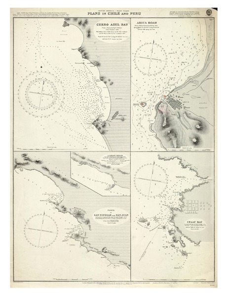
Plans in Chile and Peru South America - West Coast [material cartográfico] :


Descripción Física
4 mapas en 1 hoja : blanco y negro ; 48 x 63 cm, en hoja 69 x 52 cms.
Notas
General
Datos técnicos: Soundings in fathoms.
En extremo superior: Logotipo Hydrographic Office -- Price Two Shillings.
En extremo inferior: Small corrections: XI.13 -- Timbre señala: Correjida hasta Abr. 14 1919 Of. de Hidogr. y Nav. -- Published at the Admiralty, 19th Novr. 1894, under the Superintendence of Captain W. J. L. Wharton (William James Lloyd Wharton, 1843-1905), R. N. : F. R. S., Hydrographer -- New editions: Feb. 1897, 6th March 1912, 4th July 1913 -- Engraved by Weller & Addison.
Contenido formateado
Incluye: Cerro Azul Bay -- Arica Road -- Lomas Road -- Ports of San Nicolas and San Juan -- Isla Bay.
Forma física adicional disponible
Disponible en formato digital.
Reproducción
Reproducción electrónica. Santiago, Chile : Biblioteca Nacional de Chile, Laboratorio Digital, 2015. Objeto digital: MP0001419
Términos de uso y reproducción
Acceso en línea (dominio público) sin restricción de reproducción.
Referencia Bibliográfica
Plans in Chile and Peru South America - West Coast [material cartográfico] : London : Admiralty, 19th November 1894. [Valparaíso, Chile] : [Oficina de Hidrografía y Navegación] 14 abril 1919. 4 mapas en 1 hoja : blanco y negro ; 48 x 63 cm, en hoja 69 x 52 cms. .
Clasificaciones
Colección: Mapoteca / Colección General
Materias: Cartas náuticas
Tipo de objeto: Material cartográfico
Año: 1919
Datos de publicación: London : Admiralty, 19th November 1894. [Valparaíso, Chile] : [Oficina de Hidrografía y Navegación] 14 abril 1919.
Tipo de acceso: Acceso en línea
BN Código: MP0001419
N° Sistema: 846957
BND id: 157377