![]()
![]()
Río Hurtado (Limarí, Chile) (21)
![Central los Molles 30°30' - 70°30' [material cartográfico] : Instituto Geográfico Militar de Chile.](articles-339439_thumbnail.jpg "Central los Molles 30°30' - 70°30' [material cartográfico] : Instituto Geográfico Militar de Chile.")
IGM / Escala 1:50.000
Central los Molles [material cartográfico] Instituto Geográfico Militar de Chile.
Monte Patria (Limarí, Chile) - Mapas - Río Hurtado (Limarí, Chile)
![Cerro Tololo [material cartográfico] Instituto Geográfico Militar.](articles-352960_thumbnail.jpg "Cerro Tololo [material cartográfico] Instituto Geográfico Militar.")
IGM / Escala 1:50.000
Cerro Tololo [material cartográfico] Instituto Geográfico Militar.
Vicuña (Elqui, Chile) - Andacollo (Elqui, Chile) - Río Hurtado (Limarí, Chile) - Mapas
![Cerro Tololo (30°00'-70°45') [material cartográfico] : Instituto Geográfico Militar de Chile.](articles-339912_thumbnail.jpg "Cerro Tololo (30°00'-70°45') [material cartográfico] : Instituto Geográfico Militar de Chile.")
IGM / Escala 1:50.000
Cerro Tololo [material cartográfico] Instituto Geográfico Militar de Chile.
Vicuña (Elqui, Chile) - Andacollo (Elqui, Chile) - Río Hurtado (Limarí, Chile) - Mapas

IGM / Escala 1:50.000
Cordillera de Doña Rosa [material cartográfico] Instituto Geográfico Militar.
Río Hurtado (Limarí, Chile) - Mapas - Monte Patria (Limarí, Chile)
![Cordillera de Doña Rosa [material cartográfico] Instituto Geográfico Militar.](articles-334877_thumbnail.jpg "Cordillera de Doña Rosa [material cartográfico] Instituto Geográfico Militar.")
IGM / Escala 1:50.000
Cordillera de Doña Rosa [material cartográfico] Instituto Geográfico Militar.
Monte Patria (Limarí, Chile) - Mapas - Río Hurtado (Limarí, Chile)
![Cordillera de Doña Rosa 3030 - 7010 [material cartográfico] : Instituto Geográfico Militar de Chile.](articles-334250_thumbnail.jpg "Cordillera de Doña Rosa 3030 - 7010 [material cartográfico] : Instituto Geográfico Militar de Chile.")
IGM / Escala 1:50.000
Cordillera de Doña Rosa [material cartográfico] Instituto Geográfico Militar de Chile.
Monte Patria (Limarí, Chile) - Mapas - Río Hurtado (Limarí, Chile)

IGM / Escala 1:50.000
Embalse Recoleta [material cartográfico] Instituto Geográfico Militar.
Mapas - Ovalle (Limarí, Chile) - Río Hurtado (Limarí, Chile) - Andacollo (Elqui, Chile) - Coquimbo (Elqui, Chile) - Vicuña (Elqui, Chile)
![Embalse Recoleta (30°15' - 71°00') [material cartográfico] : Instituto Geográfico Militar de Chile.](articles-334780_thumbnail.jpg "Embalse Recoleta (30°15' - 71°00') [material cartográfico] : Instituto Geográfico Militar de Chile.")
IGM / Escala 1:50.000
Embalse Recoleta [material cartográfico] Instituto Geográfico Militar de Chile.
Mapas - Vicuña (Elqui, Chile) - Andacollo (Elqui, Chile) - Río Hurtado (Limarí, Chile) - Coquimbo (Elqui, Chile)
![Hurtado (30°15' - 70°30') [material cartográfico] : Instituto Geográfico Militar de Chile.](articles-336135_thumbnail.jpg "Hurtado (30°15' - 70°30') [material cartográfico] : Instituto Geográfico Militar de Chile.")
IGM / Escala 1:50.000
Hurtado [material cartográfico] Instituto Geográfico Militar de Chile.
Río Hurtado (Limarí, Chile) - Paihuano (Elqui, Chile) - Monte Patria (Limarí, Chile) - Mapas
![Monte Patria [material cartográfico] Instituto Geográfico Militar.](articles-339109_thumbnail.jpg "Monte Patria [material cartográfico] Instituto Geográfico Militar.")
IGM / Escala 1:50.000
Monte Patria [material cartográfico] Instituto Geográfico Militar.
Ovalle (Limarí, Chile) - Monte Patria (Limarí, Chile) - Río Hurtado (Limarí, Chile) - Mapas
![Monte Patria (30°30' - 70°45') [material cartográfico] : Instituto Geográfico Militar de Chile.](articles-339086_thumbnail.jpg "Monte Patria (30°30' - 70°45') [material cartográfico] : Instituto Geográfico Militar de Chile.")
IGM / Escala 1:50.000
Monte Patria [material cartográfico] Instituto Geográfico Militar de Chile.
Ovalle (Limarí, Chile) - Monte Patria (Limarí, Chile) - Río Hurtado (Limarí, Chile) - Mapas
IGM / Escala 1:50.000
Ovalle [material cartográfico] Instituto Geográfico Militar.
Punitaqui (Limarí, Chile) - Mapas - Río Hurtado (Limarí, Chile) - Monte Patria (Limarí, Chile) - Ovalle (Limarí, Chile)
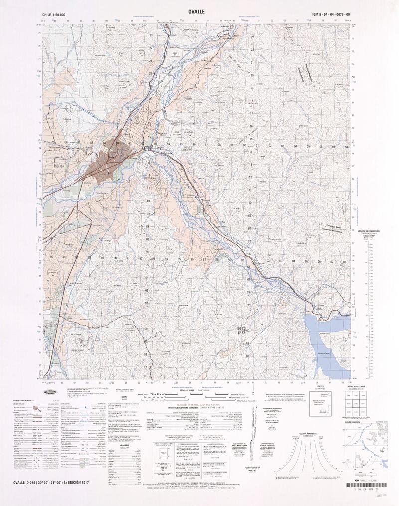
![Ovalle (30°30' - 71°07') [material cartográfico] : Instituto Geográfico Militar de Chile.](articles-339085_thumbnail.jpg "Ovalle (30°30' - 71°07') [material cartográfico] : Instituto Geográfico Militar de Chile.")
IGM / Escala 1:50.000
Ovalle [material cartográfico] Instituto Geográfico Militar de Chile.
Ovalle (Limarí, Chile) - Monte Patria (Limarí, Chile) - Río Hurtado (Limarí, Chile) - Punitaqui (Limarí, Chile) - Mapas

IGM / Escala 1:50.000
Paso de Doña Rosa [material cartográfico] Instituto Geográfico Militar.
Río Hurtado (Limarí, Chile) - Mapas
")
IGM / Escala 1:50.000
Paso de Doña Rosa [material cartográfico] Instituto Geográfico Militar de Chile.
Río Hurtado (Limarí, Chile) - Mapas

IGM / Escala 1:50.000
Pichasca [material cartográfico] Instituto Geográfico Militar de Chile.
Mapas - Río Hurtado (Limarí, Chile) - Andacollo (Elqui, Chile)

IGM / Escala 1:50.000
Río la Gloria [material cartográfico] Instituto Geográfico Militar.
Vicuña (Elqui, Chile) - Paihuano (Elqui, Chile) - Río Hurtado (Limarí, Chile) - Mapas
![Río La Gloria 3015 - 6950 [material cartográfico] : Instituto Geográfico Militar de Chile.](articles-333676_thumbnail.jpg "Río La Gloria 3015 - 6950 [material cartográfico] : Instituto Geográfico Militar de Chile.")
IGM / Escala 1:50.000
Río La Gloria [material cartográfico] Instituto Geográfico Militar de Chile.
Paihuano (Elqui, Chile) - Río Hurtado (Limarí, Chile) - Vicuña (Elqui, Chile) - Mapas
")
IGM / Escala 1:50.000
Sierra Cochiguas [material cartográfico] Instituto Geográfico Militar de Chile.
Mapas - Paihuano (Elqui, Chile) - Río Hurtado (Limarí, Chile)
![Vicuña [material cartográfico] Instituto Geográfico Militar.](articles-354353_thumbnail.jpg "Vicuña [material cartográfico] Instituto Geográfico Militar.")
IGM / Escala 1:50.000
Vicuña [material cartográfico] Instituto Geográfico Militar.
Río Hurtado (Limarí, Chile) - Paihuano (Elqui, Chile) - Mapas - Vicuña (Elqui, Chile)
")
IGM / Escala 1:50.000